
In late May, 2013, I was sent to Cunnamulla in south-west Queensland on assignment in my 'real' job with ABC News Online.
As is always the case when I am out of the office, I took tons of stock photos - of all sorts of things, as you will see - and thought afterwards, 'with all these photos, I should do something for the blog'. Unfortunately I didn't get photos of all my accommodation but there's lots of everything else.
The great thing about heading to the bush, or the outback, as is the case with Cunnamulla, is that you see and experience things you don't in the city. There's not a lot out there but that's part of the beauty - there's nothing but there's so much. Don't ask me what that means. It just 'is'. Cities can appear the same the world over whereas once you get out into the country or, in Australia's case, the bush and the outback, you see things you won't see anywhere else. Quite often the real essence of the country comes to the fore.
I have discovered that this post runs slowly if viewed on Internet Explorer. It's best viewed on Google Chrome or Firefox (not as fast as Chrome).
I have discovered that this post runs slowly if viewed on Internet Explorer. It's best viewed on Google Chrome or Firefox (not as fast as Chrome).
.jpg)
Cunnamulla is a 10-hour drive (800km/500 miles) from Brisbane if you don't stop for too long anywhere. The route you take is Brisbane - Toowoomba - Dalby - St George - Cunnamulla (route map HERE). There many other towns and settlements along the way but these are the major centres you actually pass through.
The road itself isn't bad...well, by Australian standards that is. If you're from elsewhere in the world, you might be used to something different. However, Australia has roughly the same land size as the USA but with 1/15 the population, so we don't have the funds for dual carriageway everywhere. Plus, Cunnamulla's population is around 1,200, so there's not a lot of traffic out that way! But that's one of the nice things.
The photos in this post will concentrate mainly on Cunnamulla and St George, where I stopped on the drive to and from Cunnamulla. However, I will also include other photos from the drive, including other towns and settlements along the way, and other stuff you will more than likely see.
Anyway, enough talking...

You'll see plenty of sights like the one above, especially once you get past Dalby and, moreso, St. George. This is a stretch of the Moonie Highway (49 on the road map). Quite often I stopped the car in the middle of the road to take a photo and there was no traffic in either direction the whole time I was stopped. And the further west you travel the quieter it gets.
BRISBANE TO TOOWOOMBA
I didn't take too many photos along this stretch. I was more interested in what lay further west.
However, for the trivia-minded among you, Toowoomba is Australia's biggest inland non-capital city, with a population of over 140,000. Among other things, it is famous for the annual Carnival of Flowers, held in September each year. In 2012 I headed 'up the range' and photographed the Carnival of Flowers, the photo gallery of which can be seen HERE.
One photo I did take came about when I was driving along the Warrego Highway to 'T-Bar' (local speak for Toowoomba) on the morning I left Brisbane (or Brissie, Bris-vegas, Brisneyland in local speak). I casually looked to my left as I sped past the town of Marburg, 55km west of Brisbane, and saw this...

I've driven this stretch of road dozens of times and never seen the Try-It emu farm! I pulled over and took a few photos and I don't think the emus knew what was going on, considering it was around 6.30am on a Tuesday morning.
TOOWOOMBA TO DALBY (stopping at Oakey and Jondaryan)
Toowoomba to Dalby is 84km (52 miles). The road is quite busy with cars and trucks/semi-trailers. The Warrego Highway bypasses Oakey but I stopped off there. It is located 30km (19miles) north-west of Toowoomba and has a population of around 4,500.
Oakey
 |
| Oakey's main drag - Campbell Street. |
 |
| Oakey train station. Not busy but still functioning. |
 |
| One of the pubs in town - the Western Line Hotel, directly opposite the train station (which, I hazard to guess, is on the western line from Brisbane). There will be lots of photos of pubs in this post - they're the focal point of many, if not all, country towns. |
 |
| The Commercial Hotel, which can be found just around the corner on Campbell Street. |
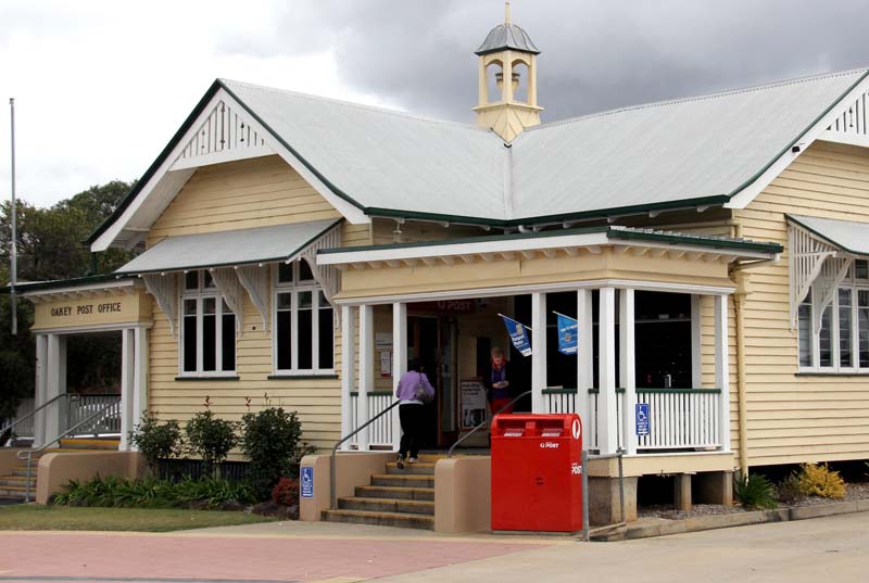 |
| Oakey Post Office. |
 |
| Standing out against the skyline - storage silos used for the likes of wheat. |
 |
| The Museum of Australian Army Flying. Oakey is home to the (Australian) Army Aviation Centre. The barracks - Swartz Barracks - are located a few km from the town and the museum is located on the perimeter of the barracks. |
 |
| Just past Oakey is the Oakey Power Station. It's right beside the highway, so you won't miss it. |
Jondaryan
Jondaryan has a population of around 500 and is pretty much a dot on the map but the Warrego Highway runs right through it. There is the Jondaryan Woolshed, which keeps tourists flocking to the area.
 |
| Statue of a shearer outside the Jondaryan Woolshed. |
 |
| Looking up the main street of Jondaryan. Not busy. The Warrego Highway is the bit of road in the foreground. |
 |
| Can't beat a rural church for quaintness - St. Anne's, Jondaryan. |
Dalby
 |
| Dalby's main drag - Cunningham Street. |
Dalby has a population of around 10,000, so it's not huge but it's not tiny, either. You can read more about Dalby HERE.
 |
| The Commercial Hotel can be found on Cunningham Street in the centre of town. |
 |
| St John's Anglican church. |
 |
| There are no scheduled flights to Dalby. The aerodrome caters only for light planes. I just liked the entrance. |
DALBY TO ST. GEORGE (passing through Moonie and Westmar)
This is where I began to enjoy myself. The traffic really drops off once you get past Dalby and I started to feel like I was getting 'remote'. I passed through two settlements, Moonie and Westmar (I'll call them micro-towns), and that was all. I was driving an office car with a good stereo but I found that the music started to intrude on the remoteness so I turned it off. Even though the sound of the car was ever-present, it was nice to be aware of my surroundings.
West of Dalby is also where you start to keep an eye out for wildlife - kangaroos mainly - that might want to share your bit of road at the same time as you. If you haven't driven out west before, dawn/early morning and late afternoon/dusk are the two times to keep a vigilant eye out for roos. In fact, if you can, it's probably best to avoid driving at these times. The last thing you need is a roo hitching a lift!
Mobile phone reception drops off once a few kms west of Dalby. I didn't get reception again until St. George, although I didn't check when I briefly stopped to take photos of Moonie and Westmar.
 |
| Moonie. |
 |
| Westmar. |
The signs you start seeing are far different to anything you see close to the built up areas. These alone make for an interesting trip...

 |
| You'll notice that either side of the road is well clear of vegetation and the like. This is so you can see any pesky stock, or wildlife, well ahead of time and not have anything bound out of roadside bushes right into your path. Also, if a tree comes down, there is plenty of room to go around it. |
 |
| Going to school, rural style. |
 |
| Something you normally don't think about in the city. I'm guessing this is for trucks and road trains. |
 |
| Speaking of road trains, these signs start appearing west of Dalby. 'Two trailers?' I hear you say. 'Meh!' I hear you say. Well... |
 |
| They get bigger west of St George. A handy hint. If a road train comes the other way, slow down to 50-60km/h and half pull over to the side of the road. Then, as it goes past, place a hand on the windscreen. This will absorb the shock if a stone should get flicked up onto your windscreen and will help prevent the windscreen from cracking. |
 |
| More wide open spaces. |
 |
| Unfortunately the wide open space on either side of the road don't prevent all roos from coming in contact with vehicles. The further west the more roadkill you see. I even saw a couple of dead cows next to the road. They had to have been victims of a truck or road train! |
* * * * *
If you like the photography in my blogs, it's because I am a professional photographer. My photos don't merely show something, they tell a story. And visual stories i.e. photos, are more interesting than pictures that merely show something.
If you'd like to know how to turn your images into visual stories, I've published a book that takes a whole new slant on photography and 'translates' the art of taking photos into a language we all understand.
To read more about my book and see some of its 100+ visual examples, please click HERE.
***I use all the tips and hints from my book in every photo I take, including those in Travel With Giulio.
ST GEORGE TO CUNNAMULLA (stopping at Bollon)
This is where the term 'outback' comes into play. It's remote out here and during the 300km (190 miles) from St. George to Cunnamulla I encountered maybe two dozen cars travelling in the opposite direction on both legs of the journey. Quite often I pulled out into the middle of the road (except for bends, of which there aren't many) and enjoyed the use of the whole road.
St. George
By the time you reach St. George, you are around 500km (310miles) west of Brisbane. This equates to, roughly, a 7-hour drive. It took me closer to 8 hours but I stopped several times to take photos and there was also quite a lot of roadworks which, hopefully by the time you do this trip, will be finished. The roadworks were nothing major - they looked to be cosmetic - but they slowed progress nonetheless.
 |
| This is the usual roadworks 'stop/go system' you will come across. |
 |
| If you're lucky, you'll get to see a stop/go person. |
I stopped at St. George for a night both on the way out and way back, staying at the Pelican Rest Tourist Park and the Merino Motor Inn. Both are very different but both were great.
The Pelican Rest Tourist Park is on the Moonie Highway on the outskirts of the town as you drive in from the Dalby side. It's a 2.5km (1.5 miles) walk into town but some of this is by the open highway, so not all that suitable. I stayed in one of their cabins and it was really comfortable and clean. The temperature out west plummet during winter and the cabin had air-conditioning to counter any chill in the air. The cabins are self-sufficient and there is a camp kitchen on site.
The Merino Motor Inn is in town and a short walk from everything. The room I had was comfortable, had air-conditioning, and is like any other motor inn you'll encounter around Australia. There is an onsite bar and licensed restaurant (food was fine) and a swimming pool. It's also a two minute walk from the FoodWorks supermarket. I ate at the restaurant (lasagne from memory) and it was fine. This was on the drive back from Cunnamulla and it had been a long day, so the lasagne and couple of beers I had went down a treat! The vegetables with dinner were, I suspect, frozen, but I was in rural Australia, so some allowances have to be made for.
I like my TV and the reception in both places was crystal clear. Neither had cable TV but they did have the terrestrial stations and all their extra channels, so that was fine. The last time I was in a rural motel, all I got on the TV was around three local stations.
* * * * * *
The first night I was there (when I stayed at 'Pelican') I drove into town and had lunch and dinner at Mummzy's Cafe Pizza on Victoria Street, the main street in town. I had a burger and fries for lunch and pizza for dinner. Not healthy, I know, but I like to live by the theory that 'food has no calories' when I'm on the road. Both were fine and I was especially impressed with the pizza.
I realise there are other eateries in town but Mummzy's was the first place I saw after a long day driving and I was hungry (and the thought of pizza in front of the TV for dinner appealed!). Anyway, I was there working for someone else and couldn't wine and dine my way around St. George for the blog.
 |
| Mummzy's Cafe in the centre of town. |
St. George is a clean, pretty town with all you might want. The town's population is around 2,500 and the district is around 3,800. This isn't huge but the town seemed to have everything you might want for.
The Moonie Highway runs right through the centre of town and doubles as the main street - Victoria Street - so it's not uncommon to see road trains driving through town.
 |
| A road train carrying bales of cotton heads down Victoria Street and through the centre of town. |
 |
| St. George lies on the Balonne River, beside which you'll find the riverside walk. |
 |
| A truck drives across the Andrew Nixon Bridge, part of the Jack Taylor Weir that spans the Balonne River in town. |
 |
| Victoria Street, which doubles as the Moonie Highway and runs through the centre of St. George. |
 |
| I didn't go into the Boomerang Cafe but I liked the look of it. |
 |
| I found four pubs in town...The Australian Hotel... |
 |
| The Cobb & Co Hotel... |
 |
| The Riverview Hotel Motel... |
 |
| And, lastly, the aptly titled St. George Hotel. |
 |
| If you don't fancy a pub, there's always the St. George RSL. |
 |
| The water tower stands head and shoulders above the rest of the skyline. |
 |
| The St. George Pump Station beside the Balonne River. |
 |
| If you fly to St. George, this is the airport. |
 |
| Where you can stock up on food supplies. |
 |
| A few kms out of town is Beardmore Dam. |
Bollon
The one town you pass through between St. George and Cunnamulla is Bollon, is 110km (70miles) west of St. George. There is a petrol station there but I played safe and fuelled up in St. George and Cunnamulla before I left both.
 |
| The Moonie Highway doubles as the main street in Bollon. |
 |
| You might get lucky and see a couple of emus wandering down the main street. |
Cunnamulla
As far as civilisaton goes, there's no a lot after Cunnamulla until you hit Perth, around 2,900km (1,800 miles) away (that's in a straight line - to drive it's around 3,700km/2,300 miles). As a result, there's a bit of an outpost feel to Cunnamulla.
I was in Cunnamulla for 24 hours and the day I arrived the area received its first decent rain in around 8 months, so the locals were happy. From my perspective, I got to see Cunnamulla is a completely different light to normal i.e. everything was wet, which didn't bode well for the reason I was there - to photograph the explosion in kangaroo numbers.
 |
| Cunnamulla next to the Warrego River. |
 |
| The centre of town, looking up Jane Street. |

The photo above is of the statue of the 'Cunnamulla Fella'. The 'fella' is no one in particular and started life as a song written in the 1950s and recorded by one of Australia most famous country singers, the late Slim Dusty. It's become a part of folklore and now represents the pastoral heritage of the area. A version of the song can be seen HERE.
 |
| The Memorial Fountain in remembrance of those who died in WWI. |
 |
| Rotunda in the centre of town. |
 |
| The Hotel Cunnamulla in the centre of town has accommodation (Trip Advisor reviews HERE). |
 |
| The Warrego Hotel Motel. It's just around the corner from the centre of town and has accommodation as well. (see the hotel's website HERE) |
 |
| Post office. |
 |
| The grandstand at John Kerr Park. |
 |
| St. Albans Anglican church. I liked the angles. |
 |
| A common sight in most rural towns - the communications tower. |
 |
| Cunnamulla Airport. |
I stayed at the Cunnamulla Cabins, which were very comfortable and clean. As you can see from the photo below, it was self-contained with all the necessary amenities. Like St. George, the TV reception was crystal clear with all the terrestrial channels and their offshoot channels.

* * * * * *
That's it for my brief outback sojourn. I hope you enjoyed it. There is a small photo gallery of some of the more outstanding photos I took on my trip and they can be seen HERE.
If you are planning on heading out to where I've been and have any questions, please drop me a line - TravelWithGiulio@gmail.com
Ciao,
Giulio
ALSO, see my 'eat, sleep and see' page for suggestions of things to do in Brisbane and SE Qld.
All photos and text by Giulio Saggin.
© Use of photos and text must be via written permission
No comments:
Post a Comment